Tag Archives: bus

Articles about buses, bus lines, bus transport, coach scheduling, timetables.  Includes GTFS, bus tracking, realtime updates and online ticketing setup for buses.

Bus and Charter Bus Conferences in 2016

We’ve rounded up Bus and Charter Bus Conferences for all of 2016! Make sure to register early so you don’t miss out on the great information and networking opportunities.

Public Transit Charter Bus Conferences

JANUARY

What: UMA Motorcoach EXPO

When: January 31- February 4, 2016

Where: The Hyatt Regency Hotel, Atlanta, Georgia, United States

Visit the United Motor Coach Association website for more information.

MARCH

What: Pennsylvania Bus Associations Marketplace

When: March 30, 2016

Where: Spooky Nook Sports Complex, Harrisburg, PA, United States

Visit the Pennsylvania Bus Association website for more information.

APRIL

What: QBIC 2016 Annual Conference

When: April 1 and 2, 2016

Where: RACV Royal Pines Resort, Gold Coast, Queensland, Australia

Visit the Queensland Bus Industry Counsil website for more information.

What: BusNSW 2016 Member Conference

When: April 13 and 14, 2016

Where: Novotel Wollongong Northbeach Hotel, Australia

Visit the BusNSW website for more information.

What: Safety Passengers Conference

When: April 5 and 6, 2016

Where: Best Western Premier Hotel, Krakow, Poland
Visit the Safety Passengers website for more information

MAY

What: International Bus Roadeo

When: May 13-17, 2016

Where: Omni Hotel, Charlotte, North Carolina, United States

Visit the American Public Transportation Association website for more information.

#APTAbus16

What: BusSA State Conference

When: May 14, 2016

Where: TBA

Visit the BusSA website for more information.

What: Bus and Paratransit Conference

When: May 15-18, 2016

Where: Westin Hotel and Charlotte Convention Center, Charlotte, North Carolina, United States

Visit the American Public Transportation Association website for more information.

#APTAbus16

JUNE

What: European Bus Forum 2016

When: June 23, 2016

Where: University of Manchester, England

Visit the European Bus Forum website for more information.

AUGUST

What: NAMO Coaches Annual Conference

When: August 18-21, 2016

Where: Resorts Casino, Atlantic City, New Jersey, United States

Visit the NAMO Coaches website for more information.

OCTOBER

What: Australian Bus and Coach Expo

When: October 5 and 6, 2016

Where: Sydney Showgrounds, Australia

Visit the Australian Bus and Coach website for more information.

What: 22nd National Conference on Rural Public and Intercity Bus Transportation

When: Oct. 2-5, 2016

Where: Renaissance Hotel, Asheville, North Carolina, United States

Visit the Rural Public and Intercity Bus Transportation website for more information.

NOVEMBER

What: BIC National Annual Conference

When: November 6-9, 2016

Where: Rendezvous Hotel, Scarborough Perth.

Visit the OzeBus website for more information.

What: Euro Bus Expo

When: November 1-3, 2016

Where: NEC, Birmingham, United Kingdom

Visit the Euro Bus Expo website for more information

Did we miss one? Let us know and we’ll add it!

Add Google Maps Public Transport directions to Your Event/Website

Here’s the three steps to add Google Maps Public Transport directions to your website.

1. Check if Google Maps has Public Transport directions for your location

Click on the following link to find out if Google Maps has public transport information for your event’s location:

https://maps.google.com/landing/transit/cities/ 

If Google has public transport for your event’s location.. Great!!  Then go to the Example (step 2) below.

If they don’t have public transport for your event’s location. It might be because your public transport provider has not yet provided Google the data in the correct format.  We suggest you contact your public transport provider and suggest they get their data on Google Maps.  If they don’t know how or need help, tell them about AddTransit or send them a link (https://addtransit.com) and we can help get their public transport (ferries, buses, trams and trains) onto Maps.

2. An Example: Public Transport Directions Using Google Maps

Here’s an example of it could look. We’ve used “Times Square, New York” as the event destination.

Try entering Boston, MA as the starting address…..


3. Add this code

Here’s the code that you will need to add to your website.  You’ll need to modify the “Times Square, New York, USA” to be the address of your event.

<form action=”https://maps.google.com/maps” method=”get” target=”_blank”>
<label for =”saddr”>Enter your starting address: </label>
<input type=”text” name=”saddr” />
<input type=”hidden” name=”daddr” value=”Times Square, New York, USA” />
<input type=”hidden” name=”dirflg” value=”r” />
<input type=”submit” value=”Show Journey” />
</form>

Publish the updated webpage and that’s it!  Done!

Hope that helps and let us know if you have any questions.

Have a great day!

Bus Driving Safety Round Up (Tips and Checklists)

Whether you drive a charter bus, shuttle bus, school bus, tour bus or city bus, you know that the lives of your passengers are in your hands every day, and we want to help keep everyone safe, including you.  We’ve rounded up some of the best driving tips and pre-trip inspection checklists on the web for you to browse through.

Bus Driving Safety Tips and Checklists

We’ll start off with some inspiration from the NYC bus driver who never had an accident in 23 years of driving.  Driver Michael Sanua says, “The most important thing isn’t to win a beef with another driver, criticize someone who doesn’t drive well, or get where you’re going at the speed of light. The most important thing is to be conscious of driving at all times, and get where you’re going safely. It may sound boring, but that’s the secret, if there is one.” Read more of his story and his 5 driving tips here:

How NYC’s Best Bus Driver Stayed Crash Free for 23 Years


The US Department of Transportation reminds bus drivers to take care of themselves first.  Get enough sleep, eat well and stay fit to be at your peak performance behind the wheel.  Read more here:

Safe Tips for Truck and Bus Drivers


The Bus and Coach Smart Move Campaign offers a series of illustrated printouts to help drivers maintain their vehicles, drive safely in tunnels, and look at the whole system- from the driver’s personal well being, to the passengers behavior, to the bus itself- to ensure that everything is functioning well.

The Coach Driver’s Checklist

Safe Driving in Road Tunnels for Professionals


The West Carroll Parish School Board shared the School Bus Pre-Trip Inspection Checklist they use.  This checklist is printable, and has space for the driver to mark off each task as it is completed.  This checklist could easily be modified or used as-is for any type of bus.  You can view it here:

School Bus Pre-Trip Inspection Checklist


This Walk Around Checklist from the Health and Safety Authority of Ireland is also printable and provides space for the driver to mark off each item as they check its condition.  View it here:

Bus/PSV Driver Walk Around Check Sheet


We hope this bus driving safety roundup was useful to you, and we’d love to hear from you!  Please share with us how you stay safe on the road.


Get Fit with Public Transit

It’s New Year’s Resolution time, and one of the most popular resolutions is getting in shape.

But what if we told you that you don’t need to get a gym membership, buy a treadmill, or start an implementing an elaborate workout plan?  You just need to implement simple, consistent habits, and public transit can help.

You already have a way to get to and from work, the grocery store, and your kid’s karate class.  Your mode of transportation is a habit, whether you walk, drive or take the bus.

According to the book The Slight Edge, “There are two kinds of habits: those that serve you, and those that don’t.”

You can make your mode of transportation serve you by also making it part of your workout routine.

In many decent sized cities, most people live about ¼ mile away from a public transit stop.  If you walk to the bus stop, then from the bus stop to your place of work, and reverse the trip on the way home, you’ll achieve a mile of walking per day.  According to livestrong.com, while walking one mile “a 135-pound  (61kg) person burns about 78 calories per mile, while a 165-pound (75kg) person burns about 96 calories during a walk of the same speed and length.”

If 96 calories doesn’t sound like much to you, you can do a few things to increase that number. Walking faster, walking up hills, and adding light hand weights are all ways to burn more calories.

Of course, getting fit isn’t just about burning calories.  Increasing flexibility improves circulation and posture, and reduces stress and risk of injury.  You can do cat-cow poses, tree poses, and shoulder shrugs right on the bus or train.

That walk to and from the public transit stop will also get you outside in the fresh air and sunshine, which can be especially hard if you work during all of the winter daylight hours.  Sunshine is thought to cause your brain to release a hormone called serotonin, which can help ward off depression.  Sunshine also causes your body to create vitamin D, which is important for bone health.

While using your public transit trip as your workout routine might not prepare you for the Olympics or give you the physique of a body builder, it does have the benefits of being easy to implement.  Often our elaborate plans sound great on paper, but our motivation quickly fades.  Implementing small steps, consistently, as part of a larger habit, is key to making lifestyle changes that actually stick long term.

If you’re already taking public transit, that’s a great start!  If not, get your local bus or light rail schedule and start getting healthier today.


Christmas and the New Year are only a few weeks away!

Do you have your holiday schedules out yet?  Are your schedules online? And we don’t mean in a PDF file that your customers have to go digging through your website to find.  You want your customers to be able to easily find your schedule on Google Maps or on their travel planning app from their phone, and you need to be able to quickly update them if bad weather causes changes.


“We’ve had our schedule just on our website for years.  Why bother with online maps and travel apps?”


Transit riders expect you to be on time, every time, and they expect your route to be consistent.  But you know that sometimes changes must be made.  Your holiday schedule may have planned changes like coordinating around the Christmas parade, or sudden changes because of bad weather or a car accident blocking the road.  Your customers will understand these hiccups if they know in advance, but not if you leave them stranded in the snow.  Getting your schedules to your customers with a simple tap on an app, will allow them to plan ahead for changes.

Santa gets his Christmas Schedules Online

Also, if you customers can find your schedule on Google, they won’t need to call your office to ask about the schedule or to complain that they can’t find it on your website.  This means less money spent on employees to answer customer calls, and most importantly, you’ll have happier customers who will want to use your service over and over.


“But we’re a small company and we can’t afford to hire an IT team to make that happen!”


You CAN afford to make it happen, and you don’t need to hire an IT team.  AddTransit can put your schedules and routes in GTFS (General Transit Feed Specification) which enables Google, Yahoo, and App Providers to easily include your data in their maps and travel planning programs.  You can be competitive with the major transit companies for a fraction of the cost.


Contact us now to get your schedule on travel planning apps before Christmas!

Google Maps – Bus Directions, Bus Routes and Bus Schedules

One of the great things about the advent of Google Maps is the ability to get not only only driving directions but also public transport directions.

Google Maps - Bus Directions, Routes &Schedules

Google uses GTFS (General Transit Feed Specification) files from the bus companies to display bus routes, bus schedules and calculate bus directions.

A passenger just needs to enter their start location and their final destination into Google Maps and choose the public transport icon.  Google then shows the passenger the public transport options.  The bus route is shown on a map and alternate travel routes (if available).  Further drill down options exist to allow the passenger to see the schedule,  alternate trip times, basic fare information and transfer details.

The ubiquitous 24×7 nature of Google maps bus directions, means that wherever there is access to the Internet (e.g. PC, tablet or smartphone, etc.) a passenger can plan their journey.  No more out of date paper time tables and complex journey planning!

Additionally, if your journey destination changes midway you can recalculate an alternate route in moments and get there faster.

Have a great day!

Google Maps Bus Routes

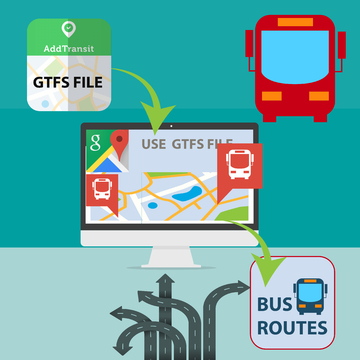
Getting your bus route to appear on Google Maps is easy with AddTransit.  Our easy to use GTFS builder allows you to create and edit a GTFS (General Transit Feed Specification) file.  A GTFS file contains the necessary information to inform Google of your stops, schedule, routes and fares.

Google Maps Bus Routes

You then notify Google that you now have a GTFS file for them to use, and subject to you meeting Google’s criteria, the file successfully passing Google’s validation and verifying that you will maintain the file going forward, Google will give you access to their Transit Dashboard.

Google also automatically uploads changes on a regular basis to ensure that their online schedules stay up to date.

Once the Google has processed your file, your customers/passengers will be able to view your bus schedules on the web in Google maps.

And the best thing is, is that the GTFS file is used not only by Google but also by lots of other companies.  This means that by creating one file you suddenly are able to make your schedule available in many different ways to your customers.

Have a good day.

Ticket booking software (Bus, Train, Ferry, Tours)

Online Ticket Reservations (Bus, Ferry, Train, Tours)

Online ticket booking software for bus, train, ferries and tours is now available at AddTransit.  Easily add your schedule, key stops and fares, add a link to your website and you are up and running!

In the past, you had to hire web specialists to create custom ticketing systems for you, but now with AddTransit you can be set up and running quickly.  You can focus on the things  that matter, while tickets are sold online.  Of course, there are administration functions that allow you to monitor bookings, capacity and make changes to bookings if passengers need assistance.

The benefits of online ticket booking software means that reservations for your bus, train or ferry service or bookings for your tours, can be managed by the customers themselves.  This allows them 24×7 flexibility in booking 365 days of the year,  removes the need to queue at your ticket counters, and allows your staff to focus on providing greater value.

We encourage you to try AddTransit for yourself.

Have a great day.

GTFS – Why you are missing out on Passengers

Increasingly, online maps and journey planning apps are the new “someone to ask” about how to get somewhere and it’s highly likely your business is not the answer they are giving…

It used to be enough just to get to #1 on Google search results.  However, that’s changed with the advent of Location Based Searches and Journey Planning smartphone Apps.  If your business involves taking passengers from A to B (and maybe back again), then to compete properly you now need your timetable, pickup and drop-offs appearing in these search results and journey apps.

More and more, tourists and irregular travellers are relying on these online mapping services to find their way around unfamiliar places and if your business is missing from these search results, then it’s highly likely they’ll choose one of the other alternatives offered.

To see if you or a business you know is missing out try this quick test.  Go to the following page (https://addtransit.com/missing-out.php) and enter one of the business’s pickup and destination locations.  If the business’s timetable and services do appear, then well done!  Otherwise, read on.

So, how do you get onto the online maps and journey planners?  Unfortunately, the schedule or timetable on your webpage, or your own custom built journey planner is just not enough.

You will need to create a GTFS file.  A GTFS file is a special type of file that contains information about your business, its schedule and timetable, and its routes and stops including their latitudes and longitudes.  The GTFS file is used by the online maps and journey planners to add your data to their systems.  There’s a number of ways to create a GTFS file, but if you have limited time or technical skills then getting a company such as AddTransit.com to do it for you, is a quick and cost effective solution.

Once the GTFS file is created, then you need to get the companies that use GTFS files to use it.  This normally involves adding a link on your website and submitting it to both GTFS directories and to the various search engines and journey planning app companies.  Each company has different submission forms, timeframes, and acceptance conditions.  If you got a company to create the GTFS file for you, then they should submit it for you.  Otherwise you’ll have to learn how to do it yourself.

Of course your timetable, stops and routes will change, so like all your marketing and customer service information, it’s important to keep the GTFS file up to date.  That way your passengers should be able to see your latest information.

Best of luck and have a great day.

How Real Time Transit Information works

Today, we thought we’d have a quick look at how real time transit vehicle tracking works…

Real time transit information
How Real time transit information works

The diagram above provides a simplistic representation on how vehicles positions are determined and then combined to provide real time transit information on a mobile phone.

Firstly the vehicle typically has an on-board Global Positioning System (GPS) device.  The GPS device uses signals from satellites, telecommunication towers and even local wifi to determine where the vehicle is physically located.  The amount of signals available will depend on the vehicle, it’s location and the specifications of the GPS device.  The greater number of signals that the device has access to, the more accurate it can be.

The GPS device will determine its position in terms of latitude, longitude and also provide a level of accuracy.  The vehicle will then transit the GPS location and some identifying information (e.g. a vehicle id, route id, etc.) via the internet to a computer.

The computer then combines a variety of vehicle’s GPS positions to produce the data in the form of a GTFS real time (GTFS-RT) data feed.  This data feed’s standardized GTFS realtime format makes it easy for Google and the various transit apps developers to display many bus, ferry, train and public transport companies information in a consistent way.  The position can be displayed on laptops, PC’s or tablets.  As the vehicle moves along, the updated position is passed through this process, allowing the end-user to identify the location of the vehicle and make informed decisions about their travel journey.

Well… that’s the simple explanation. We’ll delve into the detail in future posts.

Have a good weekend.