All posts by Neil

20 Challenges Faced by Ferry Owners

Small, medium and large passenger ferries

Here’s 20 challenges faced by Ferry Owners and their team and how GTFS can help.

1. Limited schedule accessibility

GTFS data can make ferry schedules available on major travel platforms, enhancing accessibility.

2. Seasonal schedule variations

GTFS allows for easy seasonal updates, reflecting changes in service frequency.

3. Inaccurate passenger information during disruptions

GTFS-RT can provide real-time updates on delays, cancellations, or service changes.

4. Difficulty reaching tourists

GTFS integration into tourism apps and websites can boost visibility among tourists.

5. Challenges with tide or weather-related adjustments

GTFS-RT can update schedules dynamically based on real-time weather or tidal conditions.

6. High cost of promoting routes

Using GTFS in free journey planners like Google Maps lowers marketing costs.

7. Poor route visibility in journey planners

GTFS enables ferry routes to appear in popular online maps and journey planners.

8. Complicated fare structures

GTFS can standardize fare information and integrate it with online planners.

9. Low online visibility

Publishing GTFS data makes ferry services searchable in widely used apps.

10. Regulatory compliance for public data sharing

GTFS may help meet data-sharing requirements for government and regulatory bodies.

11. Passenger safety and emergency alerts

GTFS-RT can be used to send emergency alerts directly to passengers.

12. Difficulties in route optimization

GTFS data analysis can provide insights into demand patterns for better scheduling.

13. Lack of consistent timetable updates

GTFS simplifies updating timetables across multiple platforms simultaneously.

14. Limited integration with other transport modes

GTFS data can help facilitate multimodal travel planning by integrating with buses and trains.

15. Struggles to attract commuters

GTFS integration with commuting apps and planners can make ferries more attractive.

16. Complex coordination with land transport

GTFS can help synchronize ferry schedules with connecting bus or train services.

17. Difficulty in analyzing passenger usage trends

GTFS data can be used to study route popularity and adjust service accordingly.

18. Lack of information about accessible services

GTFS can include details about accessibility, catering to passengers with special needs.

19. Challenges with onboard capacity management

GTFS data could be used to inform passengers of busy periods, helping manage crowding.

20. Inconsistent customer communication

GTFS-RT can provide timely notifications and updates to passengers.

Ready to Solve These Challenges? Join AddTransit Today!

Running a ferry service comes with unique challenges, but managing schedules, real-time tracking, and ticketing doesn’t have to be one of them. Start using AddTransit’s tools to streamline your operations, improve customer satisfaction, and boost efficiency. Sign up today to discover how we can support your ferry business with cutting-edge GTFS, real-time tracking, and ticketing solutions.

Sign Up Now and Simplify Your Ferry Operations

20 Pain Points for Bus Owners (GTFS can help!)

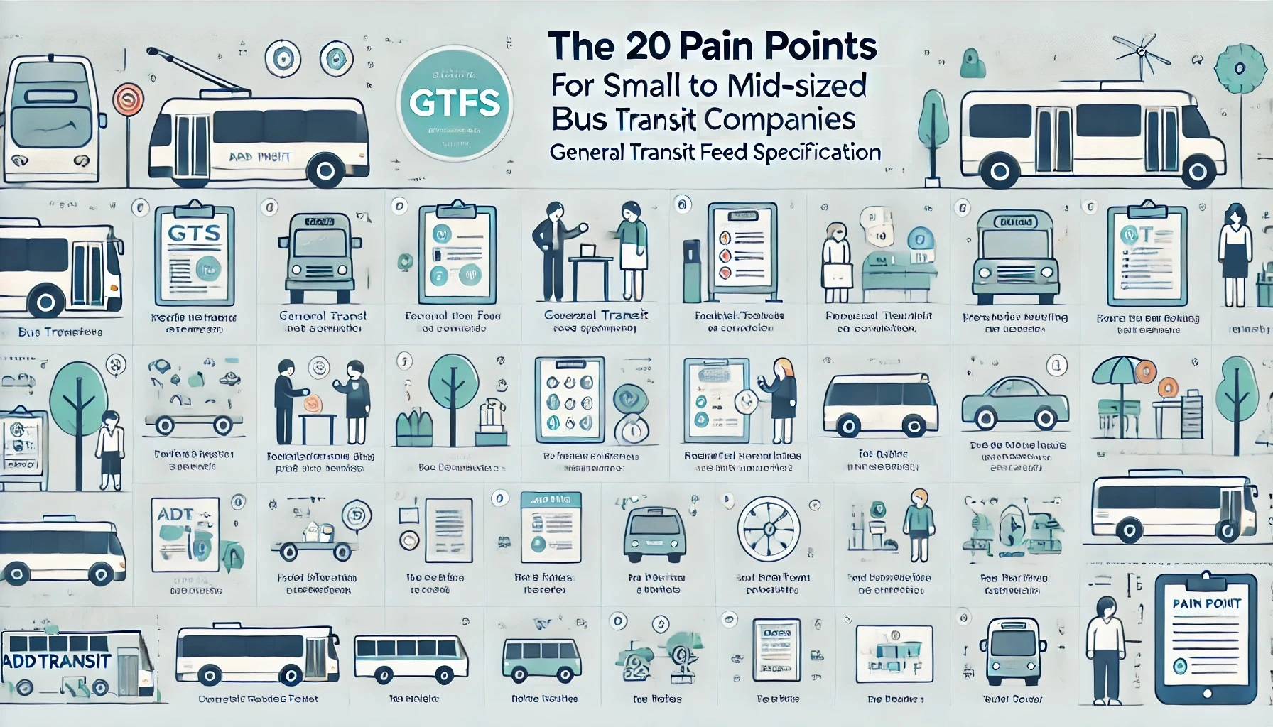
Graphic to article about twenty pain points for small to mid-sized bus & transit companies and how GTFS can help

The following table outlines 20 different pain points that small to mid-sized bus and coach operators experience in running and marketing their business and outlines how GTFS can help.

# Pain How GTFS Can Help
1 Inconsistent schedule information GTFS can provide accurate, standardized schedules for journey planners, ensuring consistency.
2 Difficulty in reaching more passengers GTFS data enables integration with popular journey planner apps like Google Maps, reaching a wider audience.
3 Poor route visibility GTFS allows routes to appear in online maps, improving route visibility for passengers.
4 Lack of real-time service updates Implement GTFS-RT (real-time extension) to provide real-time vehicle locations and delays.
5 Limited marketing resources Leveraging GTFS data in free journey planners reduces the need for traditional advertising.
6 Complexity in updating route changes GTFS simplifies the process of updating schedules and routes across multiple platforms.
7 High operating costs GTFS data analysis can identify underutilized routes, helping optimize operations.
8 Challenges in planning route expansions GTFS can be used to analyze passenger demand and optimize new route planning.
9 Poor service reliability due to traffic GTFS-RT can help by informing passengers of delays and updating journey times dynamically.
10 Difficulty in adapting schedules seasonally GTFS makes it easy to create seasonal variations in schedules and service levels.
11 Struggles with customer satisfaction Accurate GTFS data helps ensure passengers have reliable schedule information.
12 Regulatory compliance with data reporting GTFS formats may meet some local reporting requirements, reducing administrative workload.
13 Trouble integrating fare information GTFS supports fare information integration, making fare details accessible in journey planners.
14 Lack of data for decision-making Analyzing GTFS data can provide insights into route performance and passenger demand.
15 Inability to attract new customers Integrating GTFS data with trip planners can attract tech-savvy passengers.
16 Difficulty in handling service disruptions GTFS-RT can manage service alerts, notifying passengers of disruptions.
17 Limited options for providing ADA-compliant info GTFS allows encoding accessibility details like wheelchair access, improving compliance.
18 Unclear communication with passengers GTFS-RT service alerts can provide up-to-date notifications to passengers.
19 Inefficient route planning GTFS analysis can identify peak usage times, allowing for better route adjustments.
20 Fragmented passenger feedback Use GTFS data integration to analyze trip completion rates and identify areas for improvement.

Transform Pain Points into Success with AddTransit!

Tired of facing the same operational issues? AddTransit offers tailored solutions using GTFS, real-time tracking, and online ticketing to help your transit service overcome common challenges. Don’t let these pain points hold back your business—join today and see how our platform can streamline your operations and enhance your service.

Get Started with AddTransit Now

WordPress Journey Planner

We’ve made it easy for you to add a journey planner to your WordPress website.  Help your customers, increase patronage and reduce support costs by allowing potential passengers/visitors to “self serve”.

Here’s the Three easy steps.
1) Go to the WordPress page/post where you want to add the journey planner
2) Click on “Text”
3) Copy and Paste the following code where you want the journey planner to appear

<object data=”https://addtransit.com/journey-planner.php” width=”300″ height=”520″></object>

You’ll then get a Journey Planner added to the page, just like the one below.

Have a great day!


GTFS Tools – GTFS Builder, GTFS Editor and GTFS-Realtime

Getting your bus, train, ferry and public transport onto maps and apps requires GTFS Tools.  AddTransit has a set of GTFS tools that allows you start simply and then build up to more complex realtime updates.

GTFS Tools

Our GTFS tools include:

  • GTFS Builder / GTFS Editor
  • GTFS-Realtime Status updates
  • GTFS-Realtime Vehicle Tracking

Let’s discuss each of these in turn…..

GTFS Builder / GTFS Editor

GTFS Editor, GTFS Builder & other GTFS Tools

Our GTFS builder / GTFS editor allows you to create the initial GTFS file.   We step you through your agency details, the scheduled days that you operate, the routes, individual trips and stops information.  This allows you to easily build your GTFS file.  If you have existing data in stored in files (e.g. CSV, MS Excel), we even be able to upload the data for you and greatly speed up the creation of the GTFS file.  Once all the necessary information has been entered, then you can create your first GTFS file.  We can host the GTFS file for you, or you can host it on your own servers.  When your stops, routes or schedules change, you can easily log into our secure online website and use the GTFS Builder / GTFS editor to update your data.  When you are ready you can also add information about transfers, wheelchair and bike capacities, fares and route maps.

GTFS-Realtime Status Updates

GTFS-Realtime status updates

When delays affect a planned service, GTFS-Realtime status updates allow you to keep your passengers informed. You can provide customer information on what is causing the delay and what the effect will be on passenger’s travel.  The level of detail you provide is up to you. You can even provide a URL to pages on your company’s website to give even more detail.  AddTransit for GTFS-Realtime status updates can be provided to all online map, apps and journey planning providers.  This allows your passengers to choose their preferred devices and software providers.  Allowing your status updates to be displayed on many different online maps, apps and journey planners will result in the maximum number of customers being informed.

GTFS-Realtime Vehicle Tracking

GTFS-Realtime Vehicle Tracking

GTFS-Realtime Vehicle Tracking solves the problem of customers not knowing when their bus, train or ferry is about to arrive.  Using a free App on a GPS enabled smartphone with secure AddTransit login details, you can upgrade your AddTransit account to include GTFS-RealTime (GTFS-RT) Vehicle Tracking.  Initially, your staff can monitor your vehicles on the AddTransit website. When you are ready, you can also provide vehicle positions in a GTFS -Realtime file for all online map, apps and journey planning providers to use.

Related Posts:

https://addtransit.com/blog/tag/gtfs-editor/

Online Real-time Vehicle Tracking Software

Online real-time vehicle tracking software gives you the ability to view your bus positions, locate your trains and monitor your ferries or trams wherever they are.  Additionally, you can provide this same information to passengers so that they can plan their journeys and so that their friends and families can have the security of knowing when they will depart and arrive.

Real Time Vehicle Tracking Software

Vehicle Tracking Software – The Technology

AddTransit’s technology is easy to deploy.  There is no need for IT consultants or hardware that costs tens of thousands of dollars.  Instead we just add an app to a GPS enabled smartphone or tablet which is carried on the vehicle.  With the accuracy of smartphones now being approximately the size of a vehicle in an area with good mobile/cell coverage, this enables the vehicle location to easily be pinpointed.

The smartphone or tablet, then sends a secure signal using the HTTPS protocol to our servers, which then display the location on a map.

Secure and Accurate Vehicle Tracking

To ensure secure and accurate vehicle tracking, each vehicle is has its a unique identifier (e.g. a Licence Plate or Registration Number) entered and the on board company representative (e.g. driver, pilot, or other staff member) has to login.  Key trip details are also selected so that you can know which vehicle, company representative is currently logging the vehicles location.

Online  Vehicle Tracking- The Display

Tracking bus positions, or other vehicles locations is then as simple as logging into the AddTransit website.  The location of the bus, ferry, train or tram are shown on map and update at regular intervals. Depending on your need, you can select to monitor a particular vehicle, trip or route.  As the solution is online and real-time, you can monitor your vehicles from wherever your staff need to.  For example, your staff could monitor your vehicles from both the head office and from ticket sales locations, depots or docks.

Vehicle Tracking Apps, Journey Planners and Maps

Using AddTransit’s online real-time vehicle tracking also enables you to have your vehicle’s locations displayed on vehicle tracking apps, journey planners and maps.  We can provide a GTFS Real-time data feed which can be used by companies such as Google, Microsoft and Yahoo to display your vehicle’s locations on their maps.

Contact us to find out more or Sign up today!

Sell Shuttle Bus Tickets Online: Bus Reservation System

AddTransit makes it easy to sell shuttle bus tickets online.

Sell shuttle bus tickets online

All you need to do is signup, and then enter your schedule, route, fares and payment information.

We’ll then give you a small snippet of code to add to your website.  Once you’ve added the code and it is live, you are done!

Passengers can purchase tickets via your website, or via our apps.  Alternatively, we can provide you with an app that has your own branding.

Our online ticketing  system allows you to monitor past sales and future reservations 24×7.

And as passengers board you can verify they hold a valid ticket.

Join now and sell shuttle bus tickets online today!

Your Customers Expect Real Time Status Updates

Real Time Status Updates….

Customers expect Real Time Status updates

You know others are doing it.

But yes…. you’ve been putting it off.

You are fearful.  There’s a cost. People, systems and reputation.   So it’s been left to another day, another month, another year…

So what to do???  Let’s review each of these fears and see if we can turn these fears into an opportunity.

Your passengers/customers

Your customers and passengers are now expecting real time status updates.  They are tracking their parcels in real time across the globe.  They know if their Amazon book has left the warehouse, if their E-bay dress is in transit or if their pizza is just about to be delivered.  Their use of paper based maps for driving is now a increasingly historical novelty and GPS enabled smartphones is commonplace.  A decade ago it was normal not to know when things would arrive.  But now, not providing that information is seen as poor customer service.

Your team

Your team are already providing realtime status updates.  They do it by phone in the call center, at customer service centers, at stops/stations/ports and on vehicle.  However, this is a drain on your resources.  Imagine if customers/passengers could self-serve and obtain this information themselves.  This would free up your team.  They could focus on sales, upsell, and safety and instead of many team members providing best-effort updates, real time status updates allow you to ensure the right person provides the right information in the most efficient and cost effective way.

Realtime Status Systems and Software

In the past realtime status systems and software meant a massive cost investment.  Electronic signage was installed at key stops. Televisions and automated voice announcements were programmed.  Networking all these together was horrendously complicated.  And then if you wanted on vehicle realtime status systems you had to install triggers to let the vehicles know which stops had been passed and communications throughout the vehicles so all passengers could view the updates.

Luckily this huge cost outlay is no longer required.  With commuters now carrying smartphones, AddTransit can help you publish realtime status updates online.  This is a great opportunity as commuters care more about their journey, than the vehicles journey. Online realtime status updates are like Pizza delivery tracking.  You want to know how long it is until the pizza arrives at your house.  You don’t want to know all houses that the driver will delivering pizza to.  Online realtime status updates allow passengers to focus on just the information that is important to them, without being bombarded by updates that are irrelevant to their journey.  Real time status updates gives you the opportunity to provide passengers a personalized customer experience.

Your reputation

The other fear is the reputation.  The concern is that if your vehicles are late, you’ll be publishing this information for all to see.  This actually is a false fear.  Knowing that the vehicle is late allows passenger confidence in the system to rise, as now you have provided them with additional information giving them the opportunity to adjust their schedules.   Of course you’ll be looking for ways to improve on the service and minimise future delays, but in the meantime the real time status maps and apps will take the brunt of passengers displeasure with late services, and provide passengers reassurance for all the services that run perfectly.

The real time status updates opportunity

So the fears are false.  The opportunity is there.  The question now is poor customer service acceptable?  Or is it time to start real time status updates?

Find out more at https://addtransit.com/real-time-status.php

Or Join today and we’ll get you started.

Have a great day!

Cheap Vehicle Tracking Software using GTFS-Realtime

If you are looking for cheap vehicle tracking software, AddTransit is the right place.  Our smartphones apps allow you to track your vehicles and see their current position on a map.

Cheap Vehicle Tracking Software using GTFS-Realtime

So how does it work?

It is very simple, you just signup to AddTransit and then add each vehicle’s details.  You also add the users that will be allowed log into the system.

Then each of your users download the AddTransit app onto their GPS enabled smartphone.

Before they start to drive, they log into the app and select their current vehicle and their route or service. They press START and off they go.  The app keeps sending their location until they tell the app to stop.  Your smartphone is acting as a Vehicle Positioning System, but without the huge cost that is normally associated with such systems. Wow!

The vehicle location can then easily be seen in head office. If you enable GTFS Real-time (a standard that is for reporting realtime locations of vehicles), you can also make your vehicle locations available for your customers to see on internet mapping software such as Google, Bing or Yahoo Maps and journey planning apps.

No longer do you need to contact staff to find out where they are up to.  Your staff can concentrate on the safe travel of their passengers and giving these people a great customer experience.  Your passengers are even more excited as now they can know when their vehicle is approaching or is delayed and can plan accordingly.

Easy!

Have a great day.

Add Google Maps Public Transport directions to Your Event/Website

Here’s the three steps to add Google Maps Public Transport directions to your website.

1. Check if Google Maps has Public Transport directions for your location

Click on the following link to find out if Google Maps has public transport information for your event’s location:

https://maps.google.com/landing/transit/cities/ 

If Google has public transport for your event’s location.. Great!!  Then go to the Example (step 2) below.

If they don’t have public transport for your event’s location. It might be because your public transport provider has not yet provided Google the data in the correct format.  We suggest you contact your public transport provider and suggest they get their data on Google Maps.  If they don’t know how or need help, tell them about AddTransit or send them a link (https://addtransit.com) and we can help get their public transport (ferries, buses, trams and trains) onto Maps.

2. An Example: Public Transport Directions Using Google Maps

Here’s an example of it could look. We’ve used “Times Square, New York” as the event destination.

Try entering Boston, MA as the starting address…..


3. Add this code

Here’s the code that you will need to add to your website.  You’ll need to modify the “Times Square, New York, USA” to be the address of your event.

<form action=”https://maps.google.com/maps” method=”get” target=”_blank”>
<label for =”saddr”>Enter your starting address: </label>
<input type=”text” name=”saddr” />
<input type=”hidden” name=”daddr” value=”Times Square, New York, USA” />
<input type=”hidden” name=”dirflg” value=”r” />
<input type=”submit” value=”Show Journey” />
</form>

Publish the updated webpage and that’s it!  Done!

Hope that helps and let us know if you have any questions.

Have a great day!

Create GTFS Data Feeds with our GTFS Tool

Getting your company’s data appearing on Google Maps, Bing Maps,  Transit Apps and other transport software is mandatory these days.  Your passengers and customers expect to be informed all the time and when you don’t meet their expectations they become disgruntled, interact negatively with your front-line staff and drag down the reputation of your company.

But for many companies getting onto such sites is a technological challenge that is beyond them or a cost that is not factored into the budgets.  AddTransit aims to make it easy and affordable to get your transport business appearing online.

So how do you do it?

Create GTFS Data Feeds - GTFS Tool

You need to create a GTFS Data Feed and the easiest way to create a GTFS data feed is with a GTFS Tool.

GTFS Data Feed

A GTFS Data Feed is a special computer file that contains data about your route, schedule and stops/stations. GTFS is an acronym for General Transit Feed Specification.  This specification was originally developed in partnership between a public transport operator and Google.  Since then the specification has become the defacto standard for all the major internet companies (e.g. Bing, Yahoo, etc.) and also for all the smartphone, mobile and cell phone public transport and transit Apps.

The GTFS Data Feed allows you provide your transit data in single feed to all these companies; a single update that becomes accessible to all your passengers, everywhere, all the time.

GTFS Tool

When you want to create GTFS data feeds, the easiest way is using a GTFS Tool.  The GTFS tool ensures that the data is in the correct format and enforces consistencies and GTFS validations.  The tool should provide an intuitive user interface, the ability to verify geographic data on maps and where possible, prevent user errors.

The GTFS tool should allow you to easily export your first schedule and make changes to your schedule, route or stops a simple maintenance function.  We also recommend an online tool, so that if the standard changes, you will automatically get the updated software.

What Next?

Well, if you’d like to get your schedule, routes, stops onto Maps.  If you’d like to make it easier for your passengers and customers to access your timetables and plan their journeys.  Or if you’d like passengers to self serve and reduce questions and queries to front line staff, then we recommend you Join AddTransit and get started.

Have a great day!