Tag Archives: GTFS Editor

Articles about how to create, edit and improve a GTFS file.  Update routes, trips, stops and schedule. Tips on how to use the AddTransit GTFS Editor.

GTFS Tools – GTFS Builder, GTFS Editor and GTFS-Realtime

Getting your bus, train, ferry and public transport onto maps and apps requires GTFS Tools.  AddTransit has a set of GTFS tools that allows you start simply and then build up to more complex realtime updates.

GTFS Tools

Our GTFS tools include:

  • GTFS Builder / GTFS Editor
  • GTFS-Realtime Status updates
  • GTFS-Realtime Vehicle Tracking

Let’s discuss each of these in turn…..

GTFS Builder / GTFS Editor

GTFS Editor, GTFS Builder & other GTFS Tools

Our GTFS builder / GTFS editor allows you to create the initial GTFS file.   We step you through your agency details, the scheduled days that you operate, the routes, individual trips and stops information.  This allows you to easily build your GTFS file.  If you have existing data in stored in files (e.g. CSV, MS Excel), we even be able to upload the data for you and greatly speed up the creation of the GTFS file.  Once all the necessary information has been entered, then you can create your first GTFS file.  We can host the GTFS file for you, or you can host it on your own servers.  When your stops, routes or schedules change, you can easily log into our secure online website and use the GTFS Builder / GTFS editor to update your data.  When you are ready you can also add information about transfers, wheelchair and bike capacities, fares and route maps.

GTFS-Realtime Status Updates

GTFS-Realtime status updates

When delays affect a planned service, GTFS-Realtime status updates allow you to keep your passengers informed. You can provide customer information on what is causing the delay and what the effect will be on passenger’s travel.  The level of detail you provide is up to you. You can even provide a URL to pages on your company’s website to give even more detail.  AddTransit for GTFS-Realtime status updates can be provided to all online map, apps and journey planning providers.  This allows your passengers to choose their preferred devices and software providers.  Allowing your status updates to be displayed on many different online maps, apps and journey planners will result in the maximum number of customers being informed.

GTFS-Realtime Vehicle Tracking

GTFS-Realtime Vehicle Tracking

GTFS-Realtime Vehicle Tracking solves the problem of customers not knowing when their bus, train or ferry is about to arrive.  Using a free App on a GPS enabled smartphone with secure AddTransit login details, you can upgrade your AddTransit account to include GTFS-RealTime (GTFS-RT) Vehicle Tracking.  Initially, your staff can monitor your vehicles on the AddTransit website. When you are ready, you can also provide vehicle positions in a GTFS -Realtime file for all online map, apps and journey planning providers to use.

Related Posts:

https://addtransit.com/blog/tag/gtfs-editor/

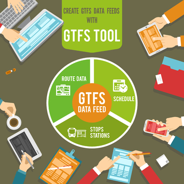
Create GTFS Data Feeds with our GTFS Tool

Getting your company’s data appearing on Google Maps, Bing Maps,  Transit Apps and other transport software is mandatory these days.  Your passengers and customers expect to be informed all the time and when you don’t meet their expectations they become disgruntled, interact negatively with your front-line staff and drag down the reputation of your company.

But for many companies getting onto such sites is a technological challenge that is beyond them or a cost that is not factored into the budgets.  AddTransit aims to make it easy and affordable to get your transport business appearing online.

So how do you do it?

Create GTFS Data Feeds - GTFS Tool

You need to create a GTFS Data Feed and the easiest way to create a GTFS data feed is with a GTFS Tool.

GTFS Data Feed

A GTFS Data Feed is a special computer file that contains data about your route, schedule and stops/stations. GTFS is an acronym for General Transit Feed Specification.  This specification was originally developed in partnership between a public transport operator and Google.  Since then the specification has become the defacto standard for all the major internet companies (e.g. Bing, Yahoo, etc.) and also for all the smartphone, mobile and cell phone public transport and transit Apps.

The GTFS Data Feed allows you provide your transit data in single feed to all these companies; a single update that becomes accessible to all your passengers, everywhere, all the time.

GTFS Tool

When you want to create GTFS data feeds, the easiest way is using a GTFS Tool.  The GTFS tool ensures that the data is in the correct format and enforces consistencies and GTFS validations.  The tool should provide an intuitive user interface, the ability to verify geographic data on maps and where possible, prevent user errors.

The GTFS tool should allow you to easily export your first schedule and make changes to your schedule, route or stops a simple maintenance function.  We also recommend an online tool, so that if the standard changes, you will automatically get the updated software.

What Next?

Well, if you’d like to get your schedule, routes, stops onto Maps.  If you’d like to make it easier for your passengers and customers to access your timetables and plan their journeys.  Or if you’d like passengers to self serve and reduce questions and queries to front line staff, then we recommend you Join AddTransit and get started.

Have a great day!


GTFS Editor, GTFS Validation Tool and GTFS Viewer

There’s a number of challenges with the GTFS format.  One is the complexity in it’s simplicity.

Let me explain…..

The GTFS format uses a relatively old way of storing data.  The method is CSV.   Here’s what Wikipedia says:

A comma-separated values (CSV) file stores tabular data (numbers and text) in plain text. Each line of the file is a data record. Each record consists of one or more fields, separated by commas. The use of the comma as a field separator is the source of the name for this file format.  Comma-separated values is a data format that pre-dates personal computers by more than a decade: the IBM Fortran (level G) compiler under OS/360 supported them in 1967.

There’s a CSV file for each type of data (e.g. trips, routes, schedules, etc.) and these files are all zipped (a type of compression) to create a GTFS file.

The simplicity means that a GTFS file could be created with the use of the most basic editor and a program such as Winzip.

However the complexity comes, when you realise that each of the files have to reference each other.  MS Excel tools (GTFS xls tool) have been coded but they are limited in their functionality and lack in inherent strength that GTFS brings with online maps.

GTFS Validation, GTFS Editor and GTFS Tool. Get schedules on Maps

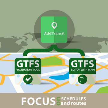
That’s why we created AddTransit.  Our software includes a GTFS builder, GTFS validation tool and a GTFS editor with maps to view the locations and routes.  Our software removes the need for you to worry about files, zipping and cross referencing between files.  We provide warnings if there is gaps with the aim of making your job easier.

This allows you to focus on your schedules and routes, and let’s you leave the intricacies of GTFS to us.  Here’s the AddTransit GTFS Tools signup link if you want to Get Started.

Have a great day.